
Garmin eTrex SE
4.2Editor score
Automatic Geocaching Live updates
Long battery options available
Multi-GNSS positioning support
A dependable handheld GPS for geocaching should remain easy to operate under trees, beside cliffs, and across changing terrain. The most useful models combine accurate positioning, readable maps, dependable batteries, weather resistance, and convenient ways to transfer or download cache information before a trip begins.
We compared ten handheld navigators using the specifications provided for each product, emphasizing satellite-system support, display size and readability, mapping capabilities, electronic compasses, altimeters, storage, connectivity, and intended field use. The list covers basic paperless models, modern multi-GNSS units, and larger touchscreens with cameras.
Each review explains who benefits most from a particular model and where its compromises may matter. The top selections highlight the strongest balance of navigation, geocaching, durability, and battery life, while availability and retailer offers can change at any time.
4.2Editor score

4.2Editor score

4.0Editor score
As an Amazon Associate we earn from qualifying purchases.
The comparison below highlights the major differences among ten handheld GPS options, including display technology, positioning systems, navigation sensors, mapping, connectivity, battery design, and physical-camera features.
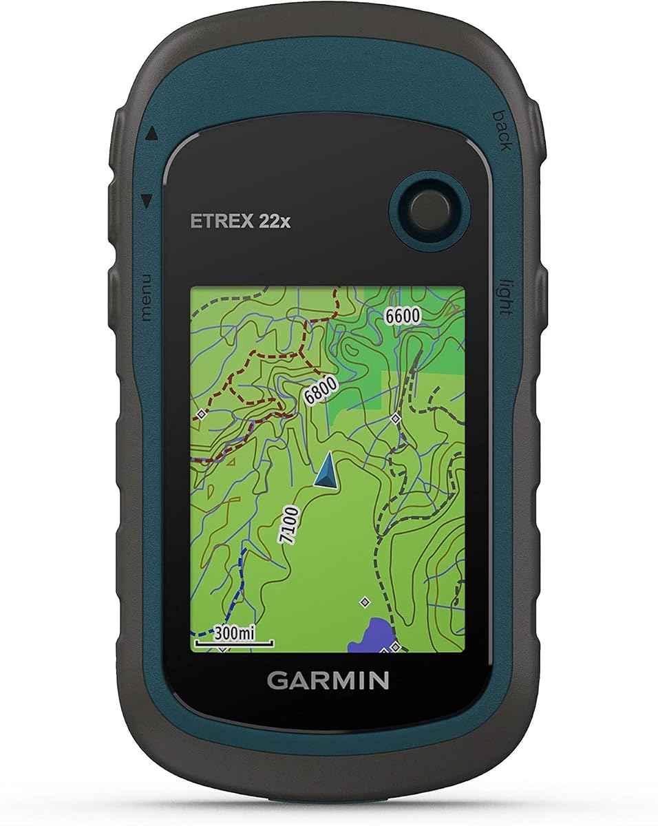
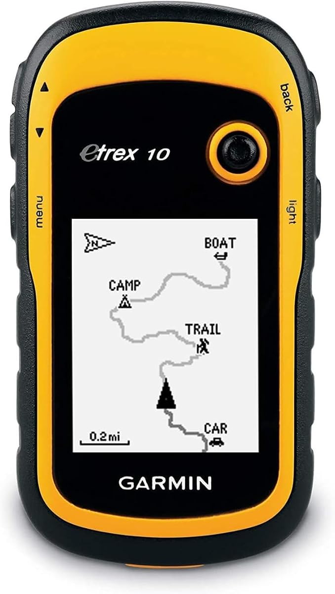


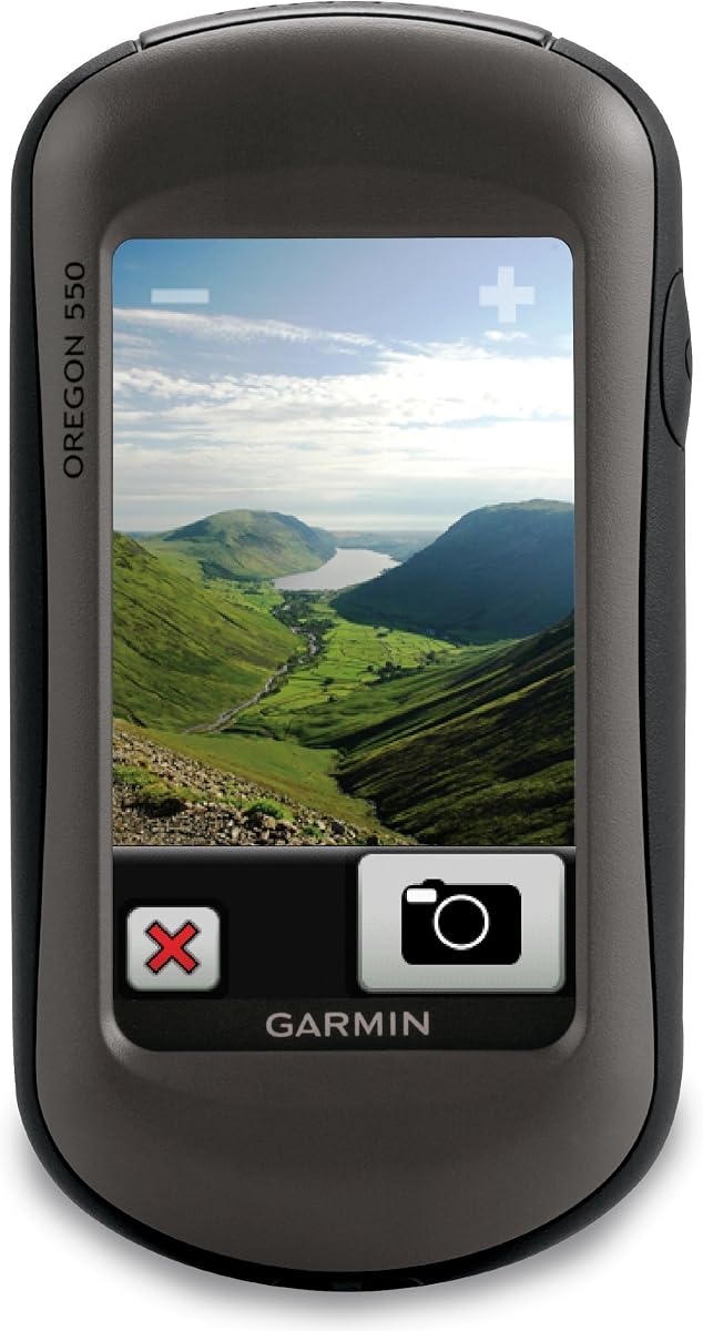

The Garmin eTrex 22x is a compact, rugged handheld GPS built for hikers and geocachers who want familiar physical controls and a dependable color display. Its 4.3 rating reflects a well-rounded feature set, with Topo Active mapping, GPS and GLONASS support, 8 GB of internal storage, and a microSD card slot. It is particularly compelling for travelers who prefer a navigator that feels straightforward rather than feature-heavy.
We may earn a commission when you buy through this link, at no additional cost to you.
The 2.2-inch sunlight-readable color screen has 240 by 320 pixels, enough resolution for recognizing terrain, routes, and cache icons without making the unit oversized. Preloaded Topo Active maps include routable roads and trails for hiking and cycling, reducing the need to build a detailed basemap before the first outing. Support for GPS and GLONASS gives the receiver access to more satellites, which can improve positioning consistency in challenging terrain.
Its main limitation is that it does not include the electronic compass and barometric altimeter found on the eTrex 32x. The 2.2-inch display is also modest when compared with larger modern models, so extensive map inspection may feel cramped. These compromises are reasonable for a buyer who values compactness, familiar buttons, expandable storage, and straightforward operation over touchscreen convenience.
Choose the eTrex 22x for day hikes, casual geocaching, travel, and situations where low weight and long battery life matter most. It is a particularly sensible first dedicated handheld or upgrade from a phone for users who want better reception and navigation away from cellular coverage. For hikers also needing altitude and heading data, the eTrex 32x is the more complete alternative.
GPS and GLONASS support gives the eTrex 22x access to multiple satellite systems, which can help maintain a useful position beneath trees or in other difficult surroundings. It remains a dedicated receiver rather than a phone-dependent application.
The included 8 GB of internal memory offers room for downloaded map content, while the microSD card slot adds flexibility. That makes the unit practical for trips beyond routine download limits or regions requiring more detailed offline coverage.
We may earn a commission when you buy through this link, at no additional cost to you.
The Garmin eTrex SE combines a readable physical-button design with one of the most useful connected features in this guide: automatic Geocaching Live updates. Its 4.2 rating reflects a modern approach to a traditional handheld, adding smartphone-assisted trip planning, software updates, smart notifications, Active Weather, cache descriptions, logs, and hints when paired with the Garmin Explore app.
We may earn a commission when you buy through this link, at no additional cost to you.
Multi-GNSS support covers GPS, GLONASS, Galileo, BeiDou, and QZSS, giving the receiver a broad selection of navigation systems. A digital compass supplies a heading even when the user is stationary, and the IPX7 water-resistant rating helps protect the unit in rain and wet environments. The 2.2-inch high-resolution display is easy to read in bright sunlight and preserves the compact shape favored by many geocachers.
The most important caveat is that AA batteries are not included, and the most compelling connectivity functions depend on a compatible smartphone. It also does not match the eTrex 22x's 8 GB storage and microSD expansion. Still, those limitations are offset by efficient automatic cache updates, extensive GNSS support, and exceptional stated battery options for buyers who want less manual preparation.
The eTrex SE is a strong recommendation for geocachers who want current cache information without repeatedly connecting the unit to a computer. It also suits hikers who value a digital compass, broad satellite support, and long expedition-mode potential. Those expecting a large screen or abundant onboard storage should consider a larger premium model, but this unit provides a particularly approachable connected experience.
When paired with the Garmin Explore app, the eTrex SE can receive automatic Geocaching Live updates containing descriptions, logs, and hints. This reduces preparation time and keeps field reference information closer to current.
The unit supports up to 168 hours in standard mode and up to 1,800 hours in expedition mode with two field-replaceable AA batteries. Those figures make it appealing for extended trips, although battery selection and operating mode will affect real-world results.
We may earn a commission when you buy through this link, at no additional cost to you.
The Garmin GPSMAP 66s is a premium-style handheld aimed at hikers and geocachers who want more screen space, richer environmental data, and wireless features. Its 4.0 rating comes with a substantial three-inch sunlight-readable color display, BirdsEye satellite imagery, a three-axis compass, and a barometric altimeter. The renewed designation may matter to buyers who prefer the supplied configuration at a reduced outlay.
We may earn a commission when you buy through this link, at no additional cost to you.
The larger display makes terrain, routes, cache descriptions, and satellite imagery easier to inspect, which is valuable when navigating unfamiliar areas or studying potential cache locations. Multiple GNSS systems improve access to satellite signals, while the compass and altimeter help establish direction and elevation. Preloaded TOPO maps for the United States and Canada provide immediate regional coverage for a major portion of the model's likely audience.
Wireless connectivity expands the unit beyond standalone navigation. Active Weather supplies forecasts and animated radar, and Geocaching Live enables mobile syncing and updates. Direct-to-device BirdsEye downloads and no annual subscription requirement are especially valuable for users who want aerial context without maintaining a recurring imagery service. The trade-offs are its larger physical footprint and the fact that this specific listing represents a renewed unit.
The GPSMAP 66s is a strong fit for long hikes, serious geocaching, and anyone who regularly examines detailed maps away from a phone screen. Prefer a compact eTrex or lower-cost model for minimal pack weight, but choose the 66s when display space, satellite imagery, weather access, and navigation sensors justify a more advanced field tool.
BirdsEye satellite imagery can be downloaded directly to the device, and the supplied feature set does not require an annual subscription. It gives geocachers a useful visual layer when topo contours alone do not make terrain relationships obvious.
The integrated three-axis compass and barometric altimeter complement the receiver by providing heading and elevation information. These tools are particularly helpful for hikers moving across slopes or navigating in poor visibility.
We may earn a commission when you buy through this link, at no additional cost to you.
The Garmin eTrex 10 is a straightforward, rugged handheld with a 4.3 rating and a clear focus on paperless geocaching. Its preloaded worldwide basemap and 2.2-inch monochrome display make it a practical choice for users who want essential navigation without a large touchscreen or elaborate sensor suite. The simple interface is especially approachable for travelers and hikers.
We may earn a commission when you buy through this link, at no additional cost to you.
A WAAS-enabled GPS receiver with HotFix and GLONASS support provides fast positioning and a more dependable signal. IPX7 waterproofing protects the device against rain and splashes, and two AA batteries deliver up to 20 hours of use. It supports paperless geocaching and Garmin spine mounting accessories, while waypoint and track features help estimate distance and travel time between points.
The monochrome display is the most important limitation. It offers less visual detail and color coding than modern color units, which can make dense maps harder to interpret. The eTrex 10 also lacks an electronic compass and barometric altimeter, so it is less suitable for hikers who depend on heading or elevation data while stationary.
Choose the eTrex 10 for straightforward paperless caching, international travel, and buyers who prioritize simplicity, worldwide mapping, and rugged construction. It is a sensible option when a compact screen and physical buttons are enough, while the eTrex 22x or eTrex SE offers a more modern color display and expanded capabilities for users who want greater visual clarity.
Dedicated paperless-geocaching support keeps cache navigation central to the device. The worldwide basemap reduces the need for detailed regional mapping, making it useful for travelers who move between different countries.
Physical controls and IPX7 protection make the unit less dependent on delicate touchscreen interaction. Two AA batteries also avoid proprietary rechargeable battery limitations, supporting trips where replacement cells are easy to carry.
We may earn a commission when you buy through this link, at no additional cost to you.
This compact rugged handheld GPS offers a 3.9 rating and a feature set aimed at hikers who prioritize screen size, map storage, and flexible positioning. Its 3.2-inch sunlight-readable display is unusually generous for a compact body, while physical buttons and an anti-slip design are intended to remain usable in demanding conditions. Preloaded USA topographic maps make it immediately relevant for many domestic trips.
We may earn a commission when you buy through this link, at no additional cost to you.
Multi-GNSS support includes GPS, Galileo, BeiDou, and QZSS, and the stated location precision reaches within 6 feet. A three-axis compass provides heading even while stationary, while a barometric altimeter adds elevation information. The 32 GB of internal memory creates generous room for downloaded maps, and waypoint and track capture functions help guide users back to a starting position.
Its rechargeable battery is rated for up to 36 hours and charges through a standard USB-C cable, avoiding the need to carry spare AA batteries. The water-resistant IP66 rating and rugged construction suit outdoor use. However, the product's 3.9 rating is the second-lowest in the list, and the preloaded topographic coverage is specifically described for the USA rather than a worldwide basemap.
This is a credible choice for hikers who want a large screen, abundant storage, broad GNSS reception, and modern USB-C charging in a relatively compact format. International travelers should confirm that appropriate regional maps are available before departure. Buyers who place greater importance on established brand consistency or a higher customer rating may prefer one of the Garmin eTrex alternatives.
With 32 GB of internal memory, the unit provides substantially more room for offline map downloads than many conventional handhelds. That capacity suits hikers who want detailed regional coverage available without a network connection.
The anti-slip body, physical buttons, and IP66 water resistance support use in wet or dusty environments. Multi-GNSS support adds positioning flexibility, while the stated six-foot precision supports close-range field navigation.
We may earn a commission when you buy through this link, at no additional cost to you.
The Garmin eTrex 32x is a well-equipped version of the rugged eTrex platform, earning a 4.2 rating while preserving the compact physical-button format. It adds a three-axis compass and barometric altimeter to the familiar 2.2-inch color display, Topo Active mapping, and GPS and GLONASS support. That combination makes it one of the most complete options for hiking and geocaching.
We may earn a commission when you buy through this link, at no additional cost to you.
Its 240 by 320 pixel screen is sunlight-readable and adequately detailed for ordinary route and terrain navigation. Preloaded Topo Active maps include routable roads and trails for cycling and hiking, while 8 GB of internal memory and a microSD card slot allow downloaded map storage. The compass provides direction without requiring movement, and the altimeter adds useful elevation and pressure information.
The eTrex 32x shares the compact display limitations of the eTrex 22x. It also supports only GPS and GLONASS rather than the broader multi-GNSS systems available on newer devices. Users who regularly need detailed aerial imagery, animated weather, or a large touchscreen may find a premium Garmin model more appropriate. For most field-oriented needs, however, the extra sensors make this model more versatile than its smaller-screen sibling.
Buy the eTrex 32x for hikers and geocachers who want a complete traditional handheld without a large touchscreen. It is particularly attractive for backpacking, orienteering-style navigation, and multi-day trips where a compass, altimeter, expandable storage, and replaceable batteries are valuable. It is our top general recommendation for the eTrex format.
The three-axis compass and barometric altimeter add information that basic GPS-only units cannot provide as conveniently. They are useful for checking heading, tracking elevation, and orienting yourself in terrain where visual landmarks are limited.
Preloaded Topo Active maps and downloadable storage give the eTrex 32x a dependable offline foundation. The microSD slot expands options for users who need more map content than the internal memory can hold.
We may earn a commission when you buy through this link, at no additional cost to you.
The Garmin Oregon 550T combines a 4.3 rating with a three-inch sunlight-readable color touchscreen, a 3.2-megapixel autofocus camera, and a useful set of navigation sensors. It is a strong choice for hikers and geocachers who want more screen space and the convenience of documenting cache locations without carrying a separate camera.
We may earn a commission when you buy through this link, at no additional cost to you.
The camera includes a 4x digital zoom and can be used to capture images around cache sites. A built-in three-axis tilt-compensated electronic compass shows heading even when the device is not held level, which is helpful during movement. The barometric altimeter tracks pressure changes to estimate altitude and can plot pressure over time, while the unit is designed to withstand outdoor conditions.
As an older platform, the Oregon 550T may not offer the breadth of modern connected features found in newer handhelds. Its touchscreen is also less convenient with cold fingers or dirty hands than physical buttons. Nevertheless, the large display, integrated camera, and accurate directional hardware create a compelling field package for users who value those features over wireless syncing.
Choose the Oregon 550T for geocaching trips where documenting finds and recording route context are important. It is well suited to hikers who want a large, map-focused display and a barometric altimeter. Those wanting current satellite imagery, extensive smartphone connectivity, or a broader GNSS roster should examine newer premium alternatives.
The integrated autofocus camera keeps a camera in the same rugged unit as the navigation tools. This is useful for geocachers who want photographs of containers, surroundings, signs, or solved locations without relying on a separate device.
The barometric altimeter estimates altitude from pressure changes and can record pressure over time. That adds useful context during mountain hikes and helps users track changing elevation without relying solely on map contours.
We may earn a commission when you buy through this link, at no additional cost to you.
The Garmin Montana 680 is a feature-rich handheld with a 4.1 rating, a large touchscreen, an 8-megapixel camera, and an unusually large preloaded geocache collection. It is designed for users who want extensive built-in geocaching information and the ability to manage waypoints, routes, and recorded tracks. Its camera can automatically geotag images, adding useful location context to trip documentation.
We may earn a commission when you buy through this link, at no additional cost to you.
The preloaded collection includes 250,000 geocaches from Geocaching.com, reducing the need to download large numbers of cache descriptions before traveling. GPS and GLONASS support, a high-sensitivity WAAS-enabled receiver, and HotFix satellite prediction are designed to acquire position quickly and maintain it under heavy cover or in deep canyons. Track Manager provides organized control over waypoints, routes, and track logs.
The included one-year BirdsEye satellite imagery subscription adds valuable visual context for planning, although the stated period is limited and users will eventually need to consider coverage beyond it. The large touchscreen and camera also make the Montana 680 bulkier than a compact eTrex or Oregon 550T. Its satellite support is limited to GPS and GLONASS rather than the newest multi-GNSS roster.
The Montana 680 appeals to dedicated geocachers who value a large onboard cache database, high-quality photography, and sophisticated track organization. It is well suited to road trips, hiking, and travel where broad offline information reduces preparation. Users prioritizing a lightweight modern unit should consider the eTrex SE, while those wanting premium wireless features can look toward the GPSMAP 66s.
With 250,000 preloaded worldwide geocaches, the Montana 680 is designed to support spontaneous finds without loading every description manually. This broad baseline is especially valuable for international travel and areas with good cellular coverage only at the trailhead.
The 8-megapixel camera captures more detailed images than the cameras in the Oregon models and records coordinates automatically. That makes the Montana useful for documenting solved puzzles, container conditions, and navigation landmarks.
We may earn a commission when you buy through this link, at no additional cost to you.
The Garmin Oregon 550 is a rugged, waterproof hiking GPS with a 4.0 rating, a three-inch sunlight-readable color touchscreen, and an integrated 3.2-megapixel autofocus camera. It provides a broad mix of navigation and documentation tools for hikers who want a durable handheld without moving to a larger camera-focused platform.
We may earn a commission when you buy through this link, at no additional cost to you.
Its 4x digital zoom camera is useful for photographing landscapes, cache containers, and trail markers. A built-in three-axis tilt-compensated electronic compass displays heading even when the user is standing still and the unit is not held level. The barometric altimeter tracks pressure to estimate altitude and can help users monitor changing weather conditions, giving this model a solid trio of environmental sensors.
A worldwide built-in basemap with shaded relief gives the Oregon 550 broad geographic coverage from the outset. More detailed maps can be added through a MapSource microSD card, though the experience predates many current wireless handhelds. Its 3-inch touchscreen may be less convenient in cold, wet, or gloved conditions, and the camera lacks the Montana 680's automatic geotagging feature.
Choose the Oregon 550 for traditional hiking, basic geocaching, and users who want a durable screen-and-camera combination. It remains a sound alternative to the Oregon 550T for general outdoor documentation, although the 550T's U.S. topographic mapping gives it an edge for detailed domestic navigation. Newer buyers focused on connected cache updates should consider the eTrex SE or GPSMAP 66s.
The built-in worldwide basemap and shaded relief provide a useful overview in regions where detailed maps have not been added. The microSD option allows users to supplement that coverage with more detailed cartography.
The tilt-compensated compass and barometric altimeter make the Oregon 550 more versatile than a basic map viewer. They provide direction and altitude information that remains useful during movement and at rest.
We may earn a commission when you buy through this link, at no additional cost to you.
The Garmin Oregon 200 is a compact portable GPS with a 3.2 rating and a 2.6-inch color TFT touchscreen. Its feature set centers on high-sensitivity GPS positioning, a built-in worldwide basemap, and five user profiles for automotive, marine, recreation, fitness, or geocaching use. It provides a convenient way to tailor the device to different activities.
We may earn a commission when you buy through this link, at no additional cost to you.
The 240 by 400 pixel display offers more color detail than monochrome models while keeping the physical format relatively portable. Rugged touchscreen construction and the worldwide basemap make it suitable for travelers who want general navigation without downloading a detailed map for every region. The profile system is particularly convenient for users who alternate between geocaching, hiking, driving, and other outdoor pursuits.
Its 3.2 rating is the lowest among the ten products, and it lacks several features found elsewhere in the list. There is no integrated camera, electronic compass, barometric altimeter, or stated modern multi-GNSS support in the supplied specifications. It also provides less map-storage flexibility and less advanced geocaching connectivity than newer handhelds.
The Oregon 200 is most appropriate for buyers who value a portable touchscreen, a worldwide overview map, and selectable activity profiles rather than premium field features. It can serve as a basic geocaching and hiking navigator, but active cache hunters will receive more from the eTrex SE or a modern Garmin unit with geocaching-focused connectivity. Its lower rating warrants checking the current listing and included accessories carefully.
Five dedicated profiles let users switch among automotive, marine, recreation, fitness, and geocaching settings. This reduces the need to carry separate devices for trips with very different navigation priorities.
The Oregon 200 provides a 240 by 400 pixel color display in a portable form. It is a reasonable option for overview navigation, although detailed map work is better served by models with larger screens and greater storage flexibility.
We may earn a commission when you buy through this link, at no additional cost to you.
The right handheld depends on how you travel, which mapping tools you use, and how much equipment you are willing to carry. The most important factors are positioning reliability, offline map coverage, screen readability, battery strategy, durability, and the convenience of moving cache data onto the device.
A geocaching handheld should acquire a position quickly and maintain it beneath trees, beside steep rock faces, and in deep canyons. Multi-GNSS support is valuable because it allows the receiver to use signals from several satellite systems, including GPS, GLONASS, Galileo, BeiDou, and QZSS, rather than relying on GPS alone. The eTrex 22x and eTrex 32x support GPS and GLONASS, while the eTrex SE and several other models offer broader multi-system reception. More systems do not guarantee perfect accuracy in every environment, but they generally improve flexibility when some constellations are blocked or unavailable.
A small display improves portability, while a larger screen makes topographic details, cache descriptions, satellite imagery, and route previews easier to examine. The 2.2-inch eTrex screens are compact and sunlight-readable, whereas the three-inch Oregon and GPSMAP displays offer more visual working space. The 3.2-inch compact rugged model is unusually large relative to its body. Touchscreens make menus and map exploration more intuitive, but physical buttons can be easier to operate with gloves, moisture, or dirt on the user's hands. The best choice balances map detail against pack weight and field conditions.
Geocaching often occurs where cellular service is weak or absent, so onboard mapping should be considered before every trip. The eTrex 22x and eTrex 32x include Topo Active maps, 8 GB of internal storage, and a microSD card slot. The compact rugged model provides 32 GB of internal memory and preloaded USA topo maps. The Oregon 550 includes a worldwide shaded-relief basemap with microSD expansion, while the Montana 680 carries 250,000 preloaded geocaches. Confirm that map detail and geocache coverage match the regions you plan to visit.
A digital compass provides heading even when you are stationary, while a barometric altimeter estimates altitude and can chart pressure changes. Both features are especially useful in mountains, dense woods, and whiteout conditions. The eTrex 32x, GPSMAP 66s, compact rugged model, Oregon 550T, and Oregon 550 include these tools. The eTrex SE includes a digital compass, while the eTrex 22x and eTrex 10 rely on a simpler navigation feature set. If direction and elevation are important to your route, these added sensors can be more useful than a larger camera or touchscreen.
Battery design determines whether a handheld suits short outings or extended trips. The eTrex 22x and eTrex 32x provide up to 25 hours in GPS mode with two AA batteries, and the eTrex 10 offers up to 20 hours. The eTrex SE provides standard and expedition power options, while the compact rugged unit uses a rechargeable battery rated for up to 36 hours and standard USB-C charging. Carry spare batteries for remote trips, and verify the stated runtime against the mode and features you intend to use. Screen brightness, wireless connections, and sensor use can all influence real-world endurance.
Weather resistance protects a navigator from rain, splashes, mud, and accidental drops. Several products are rated to IPX7, including the eTrex SE, eTrex 10, and Oregon 550T, while the compact rugged model carries an IP66 rating. A rugged body and sunlight-readable screen matter when the device is used on wet trails or exposed ridges. Water resistance is not the same as full submersion protection, so a protective case can still be worthwhile around streams, shorelines, and deep-pocket activities where knocks and abrasion are likely.
Paperless geocaching works best when the device holds current cache details, coordinates, hints, and logs. The eTrex SE stands out with automatic Geocaching Live updates through the Garmin Explore app, while the GPSMAP 66s supports Geocaching Live through wireless connectivity. The Montana 680 includes 250,000 preloaded caches, and the eTrex 10 supports paperless geocaching. Consider whether you prefer automatic syncing, manual downloads, or a large preloaded collection, and confirm that the relevant smartphone app and account workflow fit your habits.
An integrated camera can document cache containers, puzzle clues, trail conditions, and solved locations. The Montana 680 offers an 8-megapixel camera with automatic geotagging, while the Oregon 550T and Oregon 550 use 3.2-megapixel autofocus cameras with 4x digital zoom. A camera adds useful evidence and travel memories, but it also contributes weight and requires storage. For pure geocaching and navigation, a dedicated unit without a camera may be lighter and more purpose-built.
Begin by updating the handheld's software, downloading the required regional maps, and confirming that the geocaching application or companion smartphone workflow is synchronized. Save the most important route, cache coordinates, and reference information on the device before entering low-signal areas. Check the compass calibration, date, time zone, and battery compartment, and learn the physical controls before relying on the screen during a difficult approach.
During a hike, compare the handheld's position and track with visible landmarks, the map, and the stated route. Use the compass for direction and the altimeter for elevation context, but remain alert to sensor errors and local magnetic interference. At a cache, record what the listing and container show, respect geocaching guidelines, and leave the location exactly as you found it unless the cache owner or local rules specify otherwise.
After the outing, remove batteries from models that use them for long-term storage, clean dirt from seals and controls, and dry the unit before closing any compartment. Download or preserve logs, photographs, and tracks, then check the next trip's maps and forecast. Inspect the casing, straps, latches, and battery contacts regularly so small signs of wear do not become field failures.
A dedicated handheld often provides stronger satellite reception, longer field runtime, physical controls, and dependable offline maps. A phone can be useful for easy downloading, rich cache descriptions, and integrated camera tools. Many geocachers use both, relying on the phone for planning and the handheld for dependable field navigation.
Paperless geocaching means using an electronic device to view cache listings, coordinates, descriptions, hints, and logs instead of relying only on printed information. The handheld must contain the relevant cache data or connect to a compatible phone or service. The eTrex 10 supports paperless geocaching, while the eTrex SE can receive automatic Geocaching Live updates.
More satellite systems can improve positioning flexibility in places where some signals are blocked by trees or terrain. Multi-GNSS support may include GPS, GLONASS, Galileo, BeiDou, and QZSS. Even with several systems available, no device is infallible, so users should still follow marked trails, observe local conditions, and carry appropriate backup navigation tools.
They are not essential for every cache, but they can be valuable on mountainous routes and in poor visibility. A compass provides direction when stationary, while an altimeter estimates elevation and tracks pressure changes. The eTrex 32x, GPSMAP 66s, Oregon 550T, and Oregon 550 combine these sensors with dedicated navigation.
Required storage varies with region, detail level, and whether additional cache data is included. The eTrex 22x and eTrex 32x provide 8 GB plus microSD expansion, while the compact rugged model includes 32 GB. The Montana 680 also has a large preloaded geocache collection, so compare both map storage and the amount of cache information you expect to carry.
Models with IPX7 or IP66 ratings are designed to tolerate rain, splashes, and exposure to dust or water jets as specified. Water resistance does not make every unit suitable for submersion, and a sealed protective case adds protection during falls or rough handling. Keep ports closed, dry the device after exposure, and inspect the seals before each major trip.
Spare AA batteries are a sensible backup for longer trips, especially with models that use replaceable cells. The eTrex SE and eTrex 32x use AA batteries, while the compact rugged model uses a rechargeable battery and USB-C charging. Carry the backup power method appropriate to your route and the expected duration away from reliable charging opportunities.
Downloaded maps are essential for dependable use away from cellular coverage. Preloaded topo maps or a worldwide basemap provide a starting point, but detailed regional maps may still be needed for trails, roads, and local terrain. Confirm coverage for the entire trip area and refresh it before departure whenever the device supports map updates.
The Garmin eTrex 32x offers the strongest overall balance for many geocachers because it combines a readable color display, topo mapping, expandable storage, multi-system positioning, a compass, and an altimeter in a compact body. The eTrex SE is the most attractive connected and value-oriented option, especially for buyers who want automatic cache updates and broad GNSS support. The GPSMAP 66s is the premium choice when a large display, BirdsEye imagery, wireless weather, and rich environmental features justify a larger system.
Prioritize the features that match your actual trips. Compact users may prefer the eTrex 22x, basic paperless navigation is well served by the eTrex 10, and camera-oriented geocachers can examine the Oregon 550T, Oregon 550, or Montana 680. In every case, verify regional maps, cache syncing, satellite support, battery needs, and water resistance before the trip rather than relying only on the specification list.
Retailer availability, bundle contents, and device condition can change over time, particularly for renewed or older models. Check the current listing, included accessories, map compatibility, and account requirements before purchasing. The most dependable choice is the one you understand well, can keep powered for the entire outing, and can operate confidently when your phone has no service.